Mount Phoukas in the north-eastern Peloponnese (known as Apesas in antiquity) is a fascinating mountain. I don’t think it gets the attention it deserves.
It’s not a high peak (872 metres) but it really dominates the land around, with its distinctive flat top, especially if you’re driving south from Corinth.
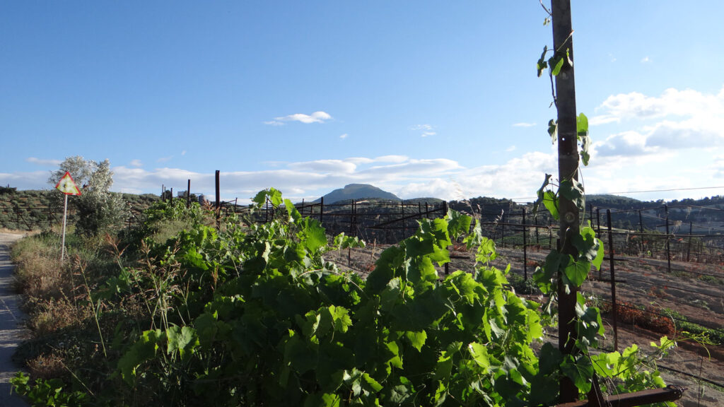
This route sets out from the village of Chalki, and takes you on to the overgrown summit plateau, where the ground is covered with the remains of ancient sacrifices.
Apesas in Myth
Most people who come here (not many) come to see spectacular monastery and the remains of the 13th-century castle on the summit plateau: they are worth the trip on their own.
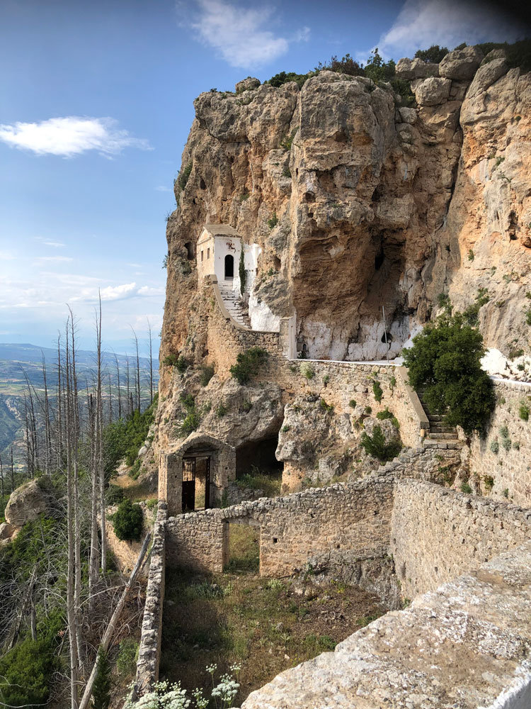
But the site also has an extraordinary history from classical antiquity too.
It’s not mentioned very many times overall in ancient Greek and Latin literature, but even so it has a real importance in many different corners of Greek mythology.
It was one of the haunts of the Nemean lion, destroyed by Herakles. The mountain was said to have been named from a shepherd, Apesantos, who was torn to pieces by the lion.

Herakles fighting the Nemean lion, white-ground lekythos, ca. 500-475 BCE, Louvre

In another version the lion is said to have fallen from the moon on to the mountain: you can imagine it touching down on the flat top, like a helicopter landing pad.
There’s also one obscure ancient source that suggests this was the mountain where Deucalion’s boat was washed up after the flood (FGrHist 156 fr. 16).
It was good for take-off too: it’s the place where Perseus took to the air, having borrowed the winged sandals of Hermes on his way to slay the Gorgon Medusa. He is said to have been the first person to sacrifice there to Zeus Apesantios.
Bone fragments
The mountain was also a place of sacrifice. It is clear that there was a huge ash altar there, covering the whole of the north-eastern edge of the summit plateau. This is a place where people brought animals for sacrifice from nearby cities, building sacrificial fires on the mountaintop. The area is about 50 metres across, roughly centred around the survey marker erected in 1952.
You can see fragments of burnt animal bones and pottery sherds scattered everywhere on the ground. The earth has a dark, ashy quality there. It’s amazing that the signs of that repeated burning process are still visible in the soil more than two millennia later.

The pottery dates from around 1000 BCE up to the 4th century BCE, so the site was in use for more than half a millennium.
The 1985 Nemea Valley survey divided the area into 10m x 10m squares, and in some squares found many as 650 sherds.
Quite a high proportion was painted fine ware pottery—in other words high-quality vessels, which may have been used for dedications. But there’s no sign of other items like figurines that were used as dedications on other summit sites, and the exceptionally large number of fragments of drinking and cooking vessels suggests that feasting took place regularly on the summit after sacrifices.
Mount Apesas and the Nemean Games
It’s impossible to reconstruct in detail what these occasions were like. But what we can say for sure is that this was a place that mattered for the communities around it.
There are several coins depicting Mt Apesas from the nearby city of Kleonai, and also one from Argos. One of the Kleonai coins is here (from the reign of Septimius Severus, 193-211 CE). The mountain is represented by the rock that the eagle is perched on. It wouldn’t be on the coins if it wasn’t an important site for these cities.
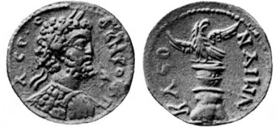
The connection with Argos is at first sight a bit puzzling, since it’s quite a long way away, but it makes more sense when we think about Apesas in relation to the festival centre of Nemea, which was the site of one of the four great athletic and equestrian festivals of Greece. Kleonai controlled the Nemean games up to the late fifth century BC, and Argos from then on.
Apesas mattered for these cities partly because it was the mountain of the Nemean games.
There’s another ancient version of the origins of the mountain’s name, which says that it comes from the fact that the horse races were started (or ‘released’, ‘set off’, aphiemi in Greek) at the base of the mountain.
The mountain loomed over the Nemean sanctuary, quite literally (if you want to know more there’s a great article by Natalie Susmann from 2021 with the title ‘Moving down the mountain’).
From the race track at Nemea, almost in line with the north end of it, you can see the distinctive flat top of the mountain—the place from which the smoke of sacrifice rose up into the sky.

The Route
The obvious way up is from the village of Chalki, to the west of the mountain.
The first half of the route is along a narrow and quiet road. If you want to reduce the distance you can drive to the end of the tarmac section: there’s space for one car to park on the grass.
You go past a farm with dogs (noisy but behind a fence when we went through) and goats.
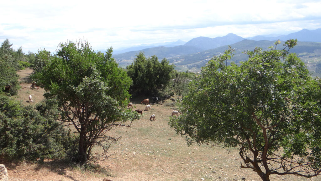
The final stretch zig-zags up to the monastery. There are great views from here to the south. The sharp triangular summit of Mount Artemisio is very conspicuous, in the centre-right of the image below, with the nearer peak of Megalovouni to the right.

From there you go through the monastery buildings, and out on to the summit plateau. It’s pretty overgrown, and slow-going, but there is a path of sorts, with occasional red paint splashes. Follow it nearly to the north-east end of the summit, and all around the fallen survey marker, for many metres on all sides, you will see pottery and bone fragments and dark, burnt earth.


There and back from Chalki is about 12 km and 600 metres of ascent.
It’s a fairly shadeless route, and it’s at a much lower altitude than many of the other routes on this site, so maybe better as a spring or autumn walk.
You can see some great aerial photos of the site here.
The start point for the route is here. The downloadable GPX file is below.