It’s quite easy to get lost on Mount Kallidromo (Kallidromos in antiquity)!
It is a place with very complex topography, and that complexity has played a central role in its history.

Thermopylae, 480 BC
The mountain is known best for its role in the battle of Thermopylae in 480 BC, as told by the Greek historian Herodotus (and many other ancient writers after him).
The famous image is of the stand of Leonidas and his 300 Spartans holding off the vast force of the Persians down at sea level, in the narrow neck of land with the sea on one side and the cliffs on the other.
But the decisive act came at a much higher altitude, when a detachment of Persians made their way over a pass on Mount Kallidromos above Thermopylae, guided by the Greek Ephialtes. They frightened away the Phokian troops stationed there to defend it, and outflanked the Spartans, attacking them from behind.
The precise route the Persians took to get up to the pass has been endlessly debated—a bit like the question of which route Hannibal took over the Alps with his elephants in his invasion of Italy.
From a quick search online you can turn up lots of hiking webpages that claim to be following the authentic route, including the annual Anopaia Atrapos trail-running race. The path they follow is the narrow trail that ascends past the Damasta monastery, on the northern slopes of Mount Kallidromos.
That standard path is a fantastic route to walk, but unfortunately it’s almost certainly not the one the Persians took!
If you look back to the scholarship on this issue from the second half of the 20th century, much of it written by ancient historians who hiked backwards and forwards endlessly over the Kallidromos trails, there’s still a certain amount of debate about how the Persians got up on to the mountain from sea level, and what route they took to descend (I might talk about those problems some other time!)
But there’s almost complete agreement that the central part of their route over the mountains ran through the high-altitude meadowland further to the south, from the village of Eleftherochori along to Nevropoli and the lake known as the Limni Kallidromou.

It’s a much more plausible route for a force of hundreds of soldiers.
The Anopaia Path
If you want the details you can search out an article by Paul W. Wallace entitled ‘The Anopaia Path at Thermopylae’, from the American Journal of Archaeology 1980. His map is reproduced below.

The historian A.R. Burn came to the same conclusion. He wrote about it in the context of two remarkable short articles in the 1950s on high-altitude routes in the Greek mountains which have been used repeatedly in both ancient and modern warfare to move large bodies of soldiers quickly and secretly.
Burn describes the valley as follows:
The upper Asopos valley runs along the top of the Anopaia or Kallidromos mountain, with the ridge of Liathitsa rising in gentle, grassy slopes on its north or right bank, and a lower parallel ridge, rising only just enough to make the place a valley at all, on the south. Between the two runs the valley, a furlong wide, flat-bottomed, full of silt, a couple of miles long (with a kink half-way, where you walk round the corner of the steep rocks of Liathitsa summit); so nearly level from end to end that the stream has cut itself deep meanders as though in an English meadow; and in April, when the snow is just melting, so full of white and purple crocuses that it is impossible to walk otherwise than on them. (Burn, ‘Helikon in history’ 315.)
This is the ‘Fair way’ that gives Mount Kallidromos its name. The topographer and historian W. Kendrick Pritchett goes so far as to call it ‘one of the loveliest places in all Greece’.
It’s a thrilling place to go. The Persians make the march at night. You can imagine the Phokians on guard there, seized with terror at the unexpected sounds of their approach – Herodotus describes their feet crunching on the leaves on the ground – and then fleeing to the nearby summit, leaving the way clear.
Cato the Elder on Mount Kallidromos
But that first battle of Thermopylae was not the only one. History repeats itself, and especially so on Mount Kallidromos: the distinctive landscape of the mountain meant that others repeated the Persian manoeuvre in similar battle situations in later centuries.
There’s a stunning example of that in Plutarch’s account of the life of Cato the Elder. In 191, Cato is serving as an officer of the Roman army against Antiochus III, king of the Seleucid empire. Antiochus has occupied the pass down at sea level, just as the Greeks had done against the Persians three centuries before. Cato leads his troops on an outflanking movement over the same pass as the Persians, also at night.
The theme of control and loss of control in the mountains is a very common one in ancient historiography: mountain territories are typically very difficult to interpret; those generals who succeed tend to be represented as exceptional figures.
Plutarch’s account of the battle is no exception:
After they had climbed up, the prisoner of war who was guiding them lost his way, and wandering about in impassable and precipitous places filled the soldiers with terrible despair and fear. Cato, seeing the danger, ordered them all to remain stationary and to wait, while he himself, taking with him a certain Lucius Manlius who was an accomplished mountain climber, went ahead with much toil and much danger, in the profound darkness of the moonless night, suffering many interruptions to his vision and lack of clarity because of the wild olive trees and the crags that stretched out in front of him, until they came upon a path which, so they thought, led down to the enemy camp, and there they put signs on some conspicuous cliffs that towered up above Mt Callidromus. They then made their way back and collected their troops, and going forward again to the signs they turned on to the path and began to move along it; but when they had gone a little way the path failed them and they found a ravine in front of them, and once again they experienced perplexity and fear, not knowing and not being able to see that they happened to have got very close to the enemy. But then the day began to dawn, and some of them thought they heard voices, and soon they were able to see a Greek camp beneath the cliff. (Plutarch, Cato the Elder 13.2-4)
Cato has the ability to navigate through this difficult and dangerous ground. There’s a constant oscillation between confidence and despair, until finally the dawn breaks and Cato is able to impose fear and confusion on his enemies decisively.
If you want to explore the details, here’s a fascinating reconstruction of Cato’s route (including lots of maps) in Jacob Morton’s 2017 UPenn PhD thesis here.
If you get lost on Mt Kallidromos, if you start to panic, if you feel that you’re going over ground you have been over before, then you’re in good company. Can you find your way along the high meadow of the Asopos valley and safely through the cliffs that lie below?
The Route
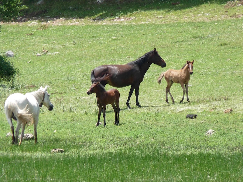
The route below gives you an easily accessible taste of the true Anopaia path, through the beautiful meadow to Nevropoli. Part of the point of the route – the reason it made the Greeks so vulnerable – is that it’s such an easy walk!

You can park in the village at Eleftherochori. From there you head up on the winding mountain road, with views down to the Malian Gulf.
Quite soon the ground levels out, and you enter into the beautiful meadow area described by Burn and others. The .gpx file below takes you along to the lake.
You can scramble up the hill that stands to the north-east of the lake. This is one candidate for the hill the Phokians retreated to when they became aware of the Persians approaching.
From there you can look westwards towards Eleftherochori, back the way you came, and see the grassy slopes of the Anopaia path stretching away into the distance.


The round trip is about 10 km, with 350 metres of ascent.
The start point for the route is here. The downloadable GPX file is below.