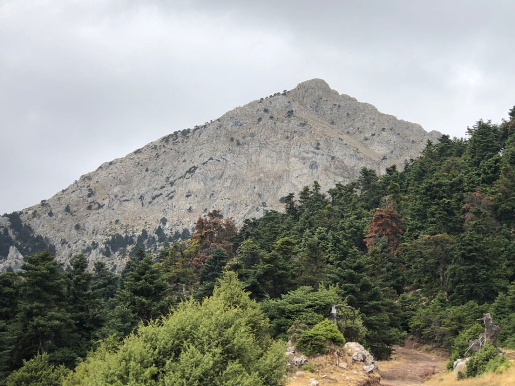
Mount Artemisio (or Artemision in ancient texts) is the most conspicuous and recognisable mountain in the eastern Peloponnese: you can see the triangular summit from a vast distance.
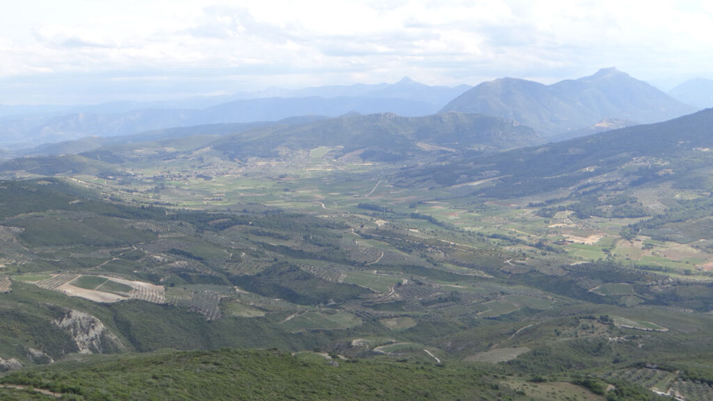
View south to Mount Artemisio (the triangular peak in the far distance, centre right) from Mount Apesas
The rocky summit ridge offers some fun scrambling opportunities, and it’s only a couple of hours drive from Athens.
This walk takes you up to the top, and gives you an opportunity to explore the way in which the ancient Greeks imagined the mountains to the west of Argos as places of divine presence.
Artemisio in Greek and Latin literature
If you look up the mountain on hiking sites online you can find some good basic information about its ancient heritage.
Most of the sites tell you that the Greek traveller Pausanias (Periegesis 2.25.3 and 8.6.6), writing in the second century CE, recorded a sanctuary and statue of the goddess Artemis on the summit.
If you dig around a bit further, you might also find the one brief mention of Mount Artemision in Apollodorus’ Library, his treasure house of mythological stories: he says that the Keryneian hind took refuge on Mount Artemision, when it had been pursued by Herakles for a year—Herakles shot it soon afterwards (another one of Herakles’ labours).
Pliny the Elder includes the mountain in a couple of lists in his Natural History: the mountains of the Argolid, and then the mountains of Arkadia (it was on the border between the two).
That’s it—no other mentions in the whole of surviving Greek and Latin literature. It’s a fairly sparse record.
On the road with Pausanias
But if we go back to Pausanias’ text and read it a bit more carefully, with attention to the passages that come before and after, we can start to see a more complex picture emerging: Pausanias is telling the story of an enchanted landscape of myth and divine presence in the territory to the west of Argos.
His standard procedure is to follow in turn the different roads that radiate out from major cities. First he takes the road from Argos to Tegea:
On the right is Mount Lykone, which has trees on it, mainly cypresses. On the summit of the mountain a sanctuary has been built in honour of Artemis Orthia [‘high’ or ‘steep Artemis’], and statues of Apollo, Leto, and Artemis have been made from white marble… When you come down again from the mountain there is a temple of Artemis on the left of the road. (2.24.5)
Artemis was goddess of hunting, associated with wild places and border territories: it’s maybe no surprise that she starts to turn up here, as we go from the plains of Argos towards the mountainous territory of Arkadia.
Mount Lykone seems to be the hill that stretches to the west of Argos, with a summit of 289 metres at its eastern edge, just to the west of Larisa. It’s a much smaller and more obscure hill than Artemision: Pausanias really cared about the detail of even these minor summits, and their religious and mythical heritage.
Further along the road comes Mount Chaon. At the base of the mountain, Pausanias tells us, where the water of the river Erasinos emerges from the ground, ‘they sacrifice to Dionysus and to Pan’ (2.24.6).
The Ancient World Mapping Center Interactive Map shows the relationship between all these mountains beautifully, if you zoom in on the area to the west of Nafplio and Argos.
Pausanias then goes back to Argos and follows the next road, the one to Mantineia. That road includes the village of Oinoe, another place that had a special association with Artemis.
The Greek tragedian Euripides tells us that Herakles ‘honoured the beast-killing goddess of Oinoe [i.e. Artemis] by slaying the golden-headed, dapple-backed hind, plunderer of the country-people’ (Herakles 375-9).

Herakles and the Keryneian hind, bronze, 1st-2nd century CE
‘Above Oinoe’, Pausanias says, ‘is Mount Artemision, and a sanctuary of Artemis on the summit of the mountain’ (2.25.3).
Then he takes a third road that leads further north to Lyrkeia, leaving Argos from the same gate as the Mantineia road. Here Lynkeus raised a beacon to show that he was safe, and his wife Hypermnestra did the same (she was the only one of the 50 daughters of Danaus not to kill her husband on their wedding night), on the Argos hill, Larisa: ‘For this reason the Argives each year hold a beacon festival’ (2.25.5).
The road goes on to Orneai, where there is a ‘sanctuary and an upright wooden statue of Artemis’ (2.25.6).
The territory of Artemis
What we see then is that Mount Artemisio is linked to a much wider landscape (and you could extend that story further by following the threads through other sections of Pausanias’ text). Pausanias’ gives us access to a vast network of mythical stories tied to specific mountain summits. These hills are all intervisible: you can see those lesser hills from the Artemisio summit.
For Pausanias this was above all a landscape of Artemis. Her shrines and statues were everywhere, not just on the summit of Mount Artemisio, which bears her name, but also guarding these border territories on the mountain roads through to Arkadia.
We can’t tell for sure whether Pausanias trekked all the way up to the sanctuary to see it for himself. But even if not his text gives us a precious hint at a culture of religious tourism even on relatively high and inaccessible mountains.
Was the sanctuary on the highest summit? We can’t know for sure (there’s no archaeological evidence), but I think it’s thrilling to imagine the statue of Artemis up there on the rocky ridge-line, gazing out over her territory, perhaps looking across to that other statue of herself on Mount Lykone.
The route
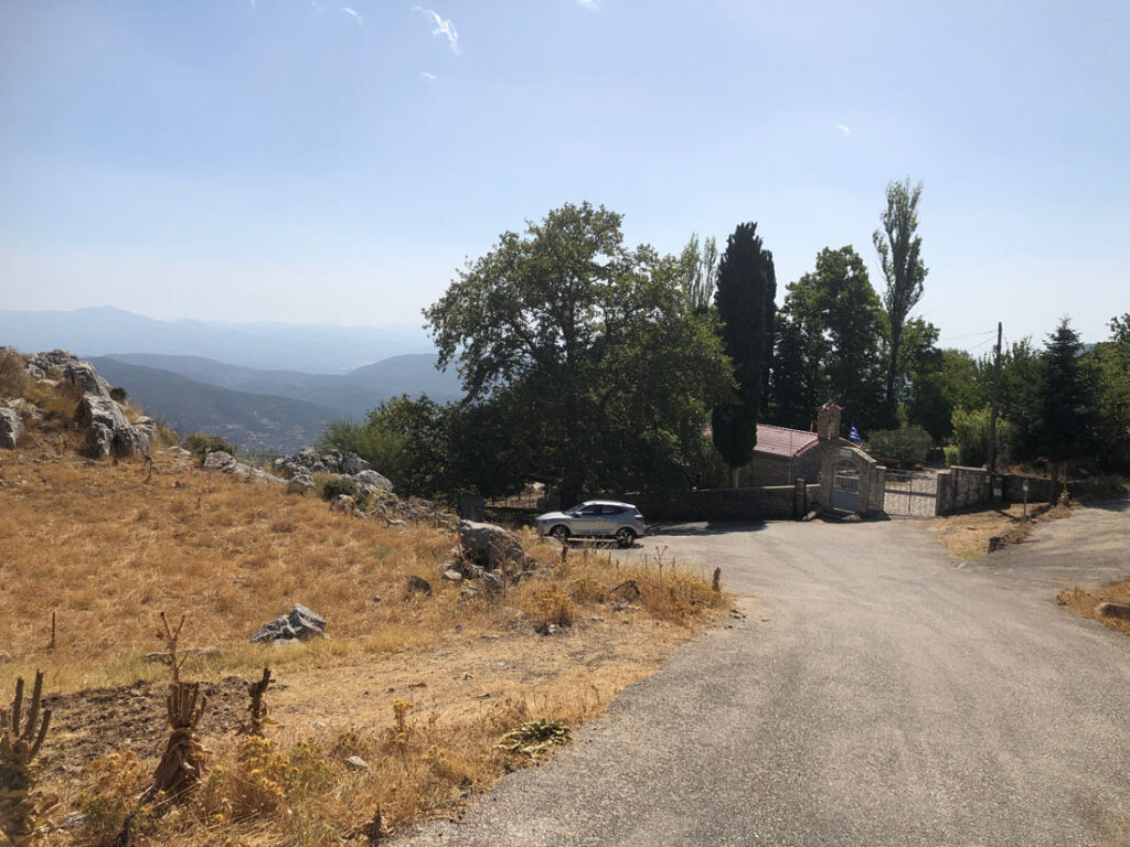
This route starts above the village of Karia. There are some parking spots by the road at the start of the route—or else you can park at the monastery a couple of switchbacks down the hill, with a welcome spring for refilling water.
There are some great route descriptions available already online if you want more detail and more photos, for example at Justforonesummer or Olympus Mountaineering.
It’s route 20 on the Anavasi 1:40,000 map (8.5) Mainalo-Artemisio-Lyrekio-Farmakas-Ktenias.
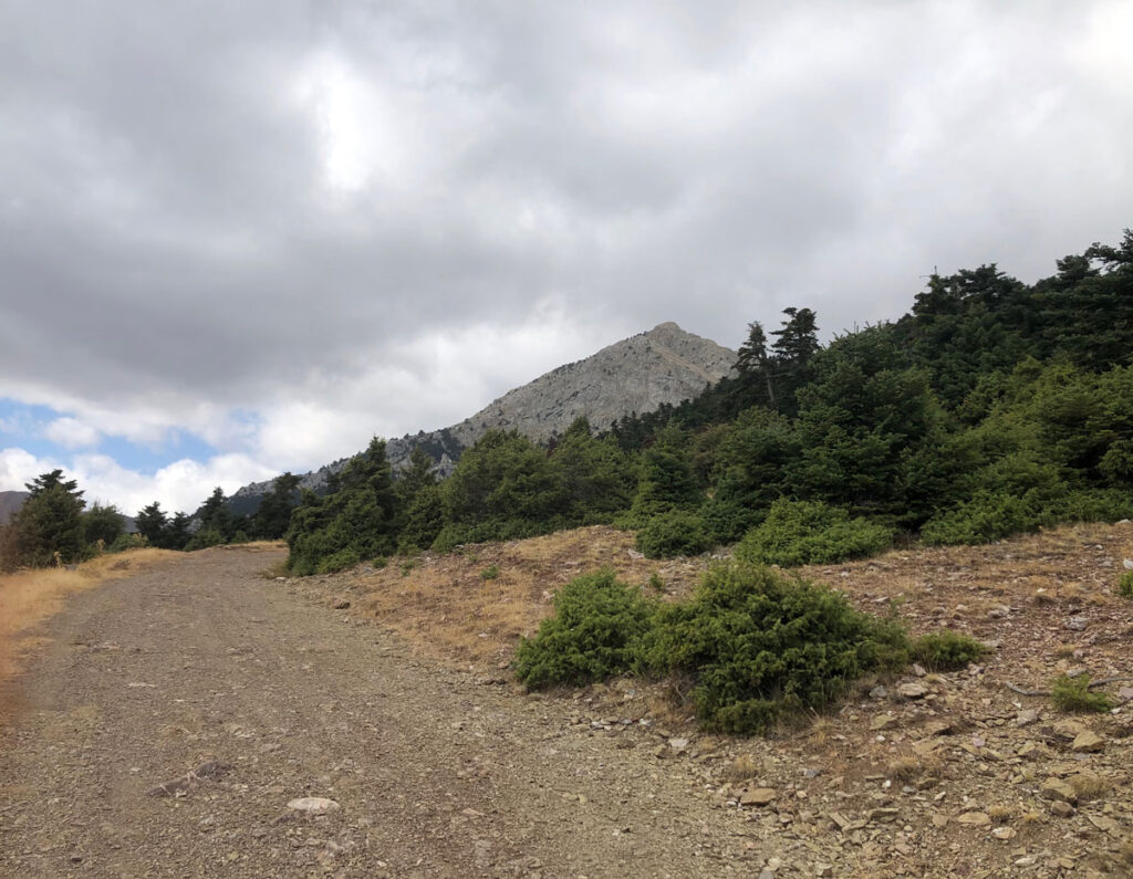
The path climbs up through forest, takes a right fork at a junction and then approaches the summit from the north, along the rocky ridge-line. From the summit it carries on to the south and loops round to rejoin the same path on the way down.
It’s important to say that the approach along the summit ridge from the north is quite exposed: if you have experience of scrambling and a good head for heights you should have no trouble in good conditions, but if you prefer to avoid that option you can just take the path that approaches the summit from the south, and then retrace your steps on the way down.
You might come across goats and dogs around 1170 metres. If you want to avoid them you can take the track that winds round to the north, clearly marked on the Anavasi map, to join the ascent path higher up at 1260 metres, more or less at the point where the Artemisio summit first comes into view.
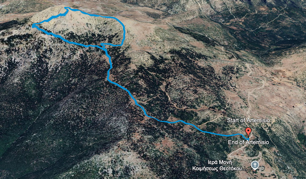
To the summit and back is 7.5 km, and 700 metres of ascent.
The start point for the route is here. The downloadable GPX file is below: