This route takes you up to the summit of Mikri Tourla, through the extraordinary high-altitude meadows of Mount Parnonas.
Border territory
Parnon was border territory in antiquity.
The mountain is mentioned only once in the whole of surviving ancient Greek and Latin literature, in a passage of Pausanias:
Above the villages stretches the mountain Parnon. On it are the borders between the Laconians, the Argives and the Tegeans. At the borders stand figures of Hermes made from stone, and the name of the place is derived from them. The river called Tanaos — the only river to descend from Parnon — flows through the territory of the Argives and reaches the sea at the gulf of Thyrea. (Pausanias, Periegesis 2.38.7)
It’s odd that Parnon doesn’t get more attention in ancient texts..
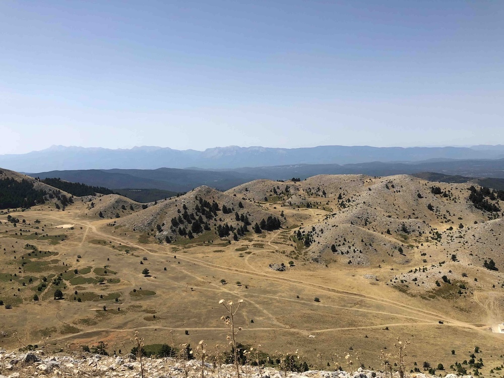
It’s a huge mountain: it covers a vast area in the southeast Peloponnese, running from north to south, roughly parallel to Mount Taygetos.
The highest summits, Megali Tourla and Mikri Tourla, are visible from a very long way away. They are very distinctive landmarks especially as you look eastwards from Sparta and the Taygetos range.

View of Parnonas from Mystras.
We can reconstruct many details of the history of the region in antiquity. This recent talk by Shannon Dunn is a great example (from 18:50 onwards), including discussion of the location and history of the Hermes monuments mentioned by Pausanias.
But for some reason the peak itself is not often named.
It’s not always clear why some Greek mountains became places of mythology and religious ritual in antiquity and some not.
But in this case maybe the mountain’s status as a disputed border territory, never clearly associated with a single city, goes some way towards explaining the invisibility of the main summit in the ancient sources.
It has a border status even in Pausanias’ text: these are the last sentences of Book 2, before Pausanias launches into an account of the region of Laconia in Book 3.
Meadowland
But even though Parnon doesn’t have its own rich mythological heritage, it made me think a lot about one very special landscape feature from ancient myth, and especially from Greek tragedy, that is meadowland.
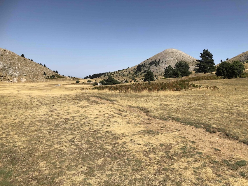
The Parnon plateau is a remarkable place. After a steep ascent you emerge into a perfectly flat, high-altitude plain, which stretches out for a couple of kilometres along the base of the two highest summits.
Distant view of the Taygetos range from the summit of Mikri Tourla.
I haven’t been there in late spring, but clearly the whole area is carpeted with flowers at that time of year.
It reminded me of the high-altitude plateau on Mount Kallidromos that the Persians passed over in their outflanking manoeuvre at the battle of Thermopylae–there’s a similar sense of unexpected space and extent.
The meadow (leimon, λειμών) in ancient Greek myth was often a place on the edges of civilisation, associated with pleasure and relaxation, but also with danger, threat, seduction or worse.
One of the classic examples (although not specifically in a mountain setting) is the meadow in the Homeric Hymn to Demeter, where Persephone is carried off by Hades:
picking flowers, roses and crocuses and beautiful violets, across the soft meadow, irises and hyacinths and narcissus, which the earth put forth by the will of Zeus as a trap for the girl with eyes like the buds of flowers. (Homeric Hymn to Demeter 6-9)
Persephone is herself flower-like, in that description of her eyes. She is liable to the same fate as the flowers she plucks.
The Parnonas plateau is not a perfect match for these mythical meadows: they are often located in mountain settings, but they tend to be more restricted spaces, a little more enclosed and claustrophobic, often with water running through them and thick vegetation.
But even so I was thinking a lot about meadows as we walked there, partly because I had just been re-reading the brilliant discussion of meadowland in Greek tragedy by Chloe Borowska in her PhD thesis.
The high-altitude meadows and pastures of Greece often feel like welcoming and beautiful places: in fact they are one of the things that make the mountains of Greece so wonderful to visit, especially when the flowers are out in the spring.
But they also feel like spaces where you are insulated from normal day-to-day experience and where the normal expectations of high-altitude landscape are suspended.
They feel like places that might be inhabited by other humans: you never quite feel alone up here, even if there is no-one else in sight.
They feel like places where unpredictable things can happen.
We were on the way down, at the southern end of the plateau, when a pick-up truck came racing towards us along the jeep track at great speed, and just for a moment I felt alarmed.
They had lost their dog. Had we seen it? We said no, and they drove on. I hope they found it.
The route
There’s a huge amount to explore around Mount Parnonas. I felt as though I had only scratched the surface on this visit, in September 2025.
It has a rich local history: for example, the Vamvakou Revival initiative has breathed new life into one village in western Parnonas, and includes a heritage mapping project that collects local stories online.
The mountain range has an enormous environmental importance, although the area is currently facing a drawn-out battle against wind turbine construction.
The route starts from the EOS refuge northeast of Vamvakou. You can park on the huge ‘football pitch’, a large open space just to the south of the refuge, at the point where the tarmac runs out.
From there you head steeply downhill, following the red squares and signs to ‘Meghali Tourla peak’ and ‘Malevi monastery’. At one point you reach the road, turn left for 50 metres, and then branch off again on a track downhill to the right.

We saw a wild boar ahead of us on the path.
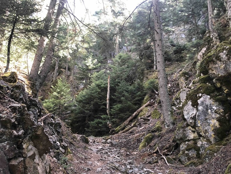
You cross the valley floor and immediately start to ascend, following a steep-sided natural corridor. My hiking companion didn’t like it and wanted to be out in the sunshine, but I loved the sense of following a secret track up to the high parts of the mountain.
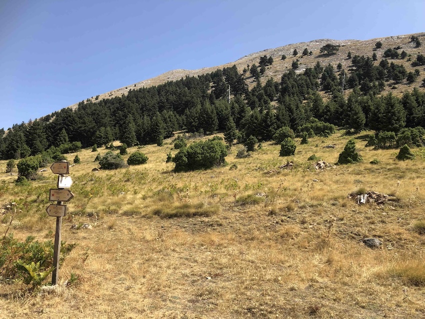
After about 2.5 km in total you come out on to a wide dirt track. You turn left and follow that west and then north, with views of the steep wooded slopes of the mountain ahead of you.

The wide track turns into a trail up through the trees. Then there is a final slog up another steep-sided gully to reach the grassy plateau.
We saw mountain tea plants (Sideritis syriaca) growing all around.
You can follow the signs to climb Megali Tourla, the highest peak, which is halfway along the plateau.
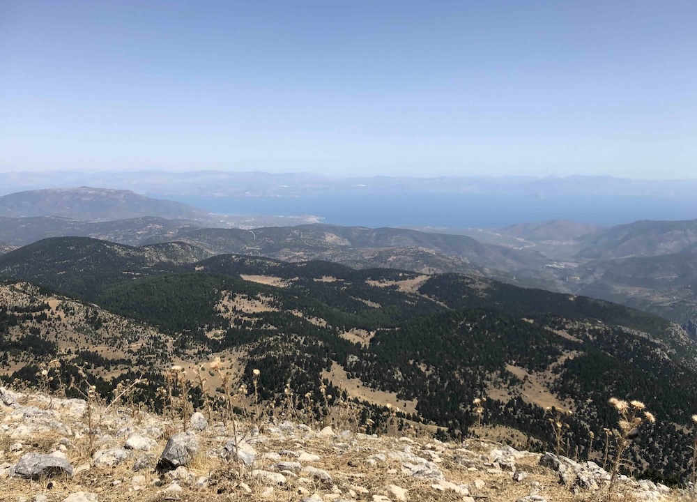
Alternatively you can go on to the chapel at the far end, and from there (as on the route map below) up to the slightly smaller Mikri Tourla, with distant views to the sea in the north-east.
For an excellent, more detailed route description, including continuation of the route northwards to the Malevi Monastery, you can look at route 20 in Michael Cullen’s Landscapes of the Southern Peloponnese, in the Sunflower Books series.


The round trip is about 14 km, with 700 metres of ascent.
The start point for the route is here. The downloadable GPX file is below.