This route takes you up to the Skipiza summit of Mount Oligyrtos, one of the best viewpoints in the Peloponnese, and gives you a glimpse of some important moments in the military history of the third century BCE.
Oligyrtos in antiquity
Oligyrtos rises up in the north central Peloponnese, north of Tripoli, and just south of Mount Kyllini.
It’s quite a high mountain, at 1935 metres, but one of the odd things about Oligyrtos is that it is mentioned so rarely in surviving Greek and Latin literature–just three times in total. For whatever reason, it doesn’t have any presence at all in Greek myth.
It has a fascinating history even so. For example, there is one ancient cave sanctuary on the mountain slopes at Tria Goupata, very high up at around 1500 metres, with the remains of thousands of dedications: pottery fragments and figurines. It seems to have been a site of popular devotion for the surrounding population from the sixth to fourth century BCE. (If you want to find out more you can have a look at this study by Gerald Schaus, at p. 139).
It also makes two intriguing appearances (two of the three surviving mentions) in Book 4 of the Histories of Polybius, who was writing in the late second century BCE. In these passages, Oligyrtos gets a fleeting moment in the limelight, as a range that at least temporarily has a strategic significance for the complex manoeuvring between different city states in the Peloponnese and beyond in the Hellenistic period.
Battle on the slopes
Polybius is telling the story of the so-called ‘Social War’ that unfolded in Greece from 220-217 BCE.
When we join the story, there has been a long-standing rivalry between the Aetolians in northern Greece, in alliance with Sparta, and the Achaeans in the Peloponnese, who are supported by the Macedonians.
When King Philip V of Macedon comes to the throne, still only 17 years old, the Aetolians feel they can push the boundaries. One particularly provocative Aetolian general, Dorimachos, launches an expedition into the Peloponnese..
In response, the Achaean League assembles a force at Megalopolis in Arcadia, led by the famous Aratus of Sicyon.
Aratus, according to Polybius, makes some terrible mistakes. Polybius does not mince his words: he says that the Achaean commanders ‘mismanaged the situation so badly that they did not fall short of the highest excess of stupidity’ (Polybius, Histories 4.11).
Aratus lines his army up for battle near to Kaphyai on the plain of Orchomenos, to the south of Oligyrtos. This encounter is usually known as the Battle of Kaphyai (or Caphyae).
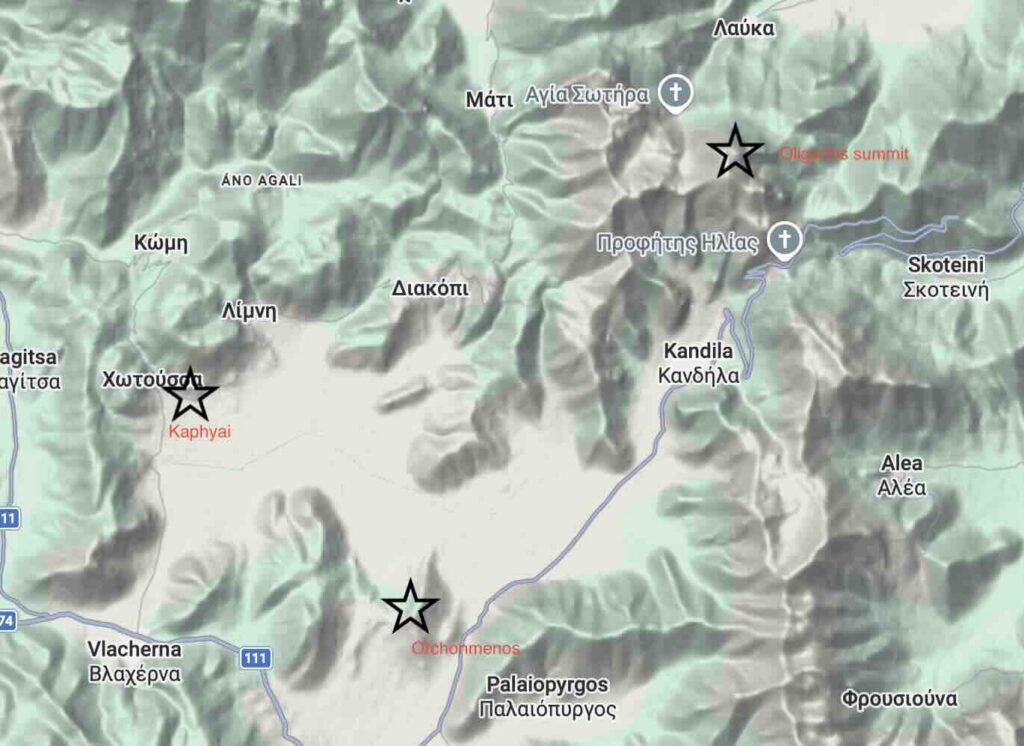
Dorimachos and the Aetolians are initially intimidated, and instead of turning to fight they march up into the hills to the north-east. Polybius says that they ‘they marched in an orderly way towards the passes over Oligyrtos’.
Aratus gives orders to follow and harass the Aetolians as they climb. The problem is that in doing so he throws away the Achaeans’ advantage on the flat, and they find themselves routed in turn by the Aetolians: ‘As they were superior in number, and as they were charging from higher ground, despite being at risk for some time they eventually put their adversaries to flight’ (4.12).
Most of the fighting seems to have taken place around the modern village of Kandhila, where the pass running to the east of Oligyrtos begins.
From the summit ridge you get a fantastic view of the terrain (photo below), looking down to Kandhila, and beyond it the narrow gap between the hills that leads out on to the plain. You can imagine both sides moving through that gap, and then the Achaeans rushing back through it out on to the plain once they have been defeated, with the Aetolians in pursuit.

‘Much snow and hardship’
The second mention comes later in Book 4. By this stage Philip of Macedon has got involved in the war, travelling secretly to the Peloponnese in winter with an army.
The Eleans, allies of the Aetolians, are on a raiding mission in the area without knowing that Philip and his troops are there. They are surprised by the Macedonians around Lake Stymphalos (north-east of Oligyrtos), and defeated.
Then Philip marches on to meet his Achaean allies further south as prearranged:
Marching through Arcadia and encountering much snow and hardship in crossing the pass of Mount Oligyrtos, he arrived at Kaphyai during the night of the third day. (4.70)
The mountains of Greece had many different passes that were important for moving troops at high altitude. The pass at Thermopylae was the most famous: it was used over and over again in successive battles. This route over Oligyrtos did not have a recurring significance in the same way, but at least for this brief period in the late third century it does seem to have had a central role, as a route over from the Stymphalian lake to the plain of Orchomenos in the south
As far as we can tell the Macedonians were using the path that runs to the east of Oligyrtos, travelling south-west from the Stymphalian lake, and then joining the route of the modern road that runs from Skotini over to Kandhila.

View of Kandhila from above, from the lower slopes of the pass.
It was not an easy route in winter: there are several accounts by 19th-century travellers describing the danger of the Kandhila pass in winter conditions before the modern road was built.
Conflict landscapes
Maybe as you hike up on the summit ridge you can catch a glimpse of the lower sections of the pass down below and imagine the Macedonians finally descending in relief to Kandhila after their ordeal in the snow.
Or maybe from you can imagine Dorimachos and his Aetolians in more or less the same place, turning the tables on the Achaeans who are harrassing them, and charging down on them from above, sending them fleeing back to the plain.
These are hills where Hellenistic soldiers marched and fought and died. Those moments of human encounter with the mountains of Greece are not competely lost to us: if we are willing to read carefully and understand the topography we can begin to bring them back to life.
The route
The route starts from the village of Lafka. It’s a very straightforward drive, just a couple of hours from Athens, with a straight road nearly all the way down from the coast: no hairpin bends to worry about! We saw a fox and hoopoes by the road as we drove, and pair of eagles in the distance.
You can park by the fountain in the village, and then follow the track steadily uphill. Watch out for the bees from the beehives that line the path: I got stung on the leg!

Every so often you have the option to branch off to take a short-cut through the woods.
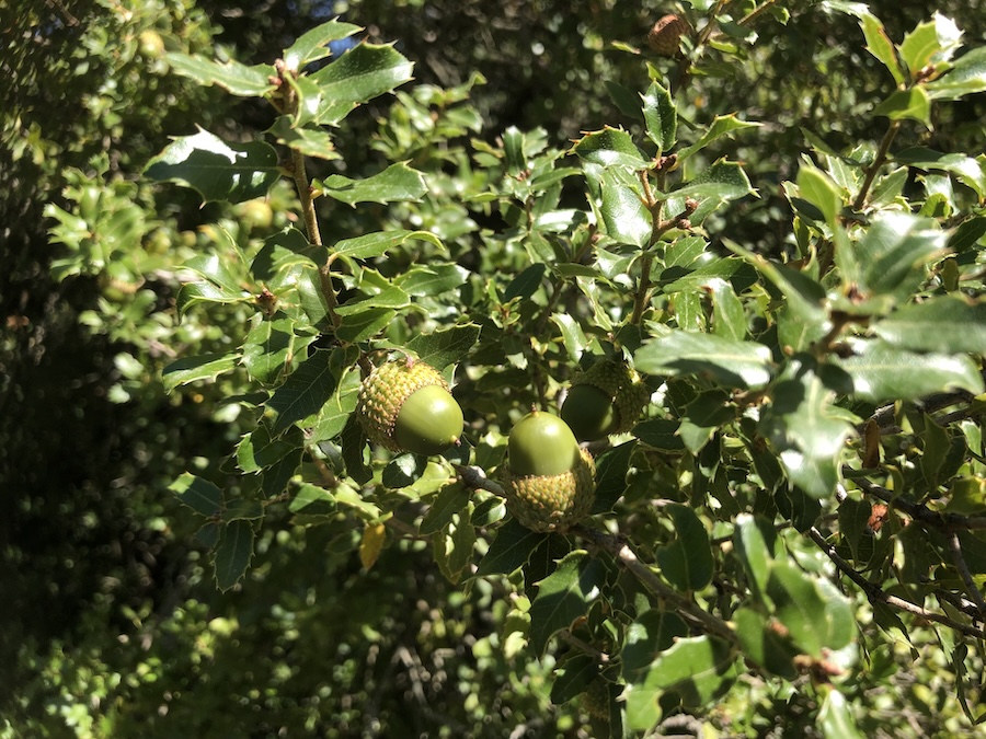
After about 2 km you come to the Agia Sotira chapel, with running water at most times of the year.
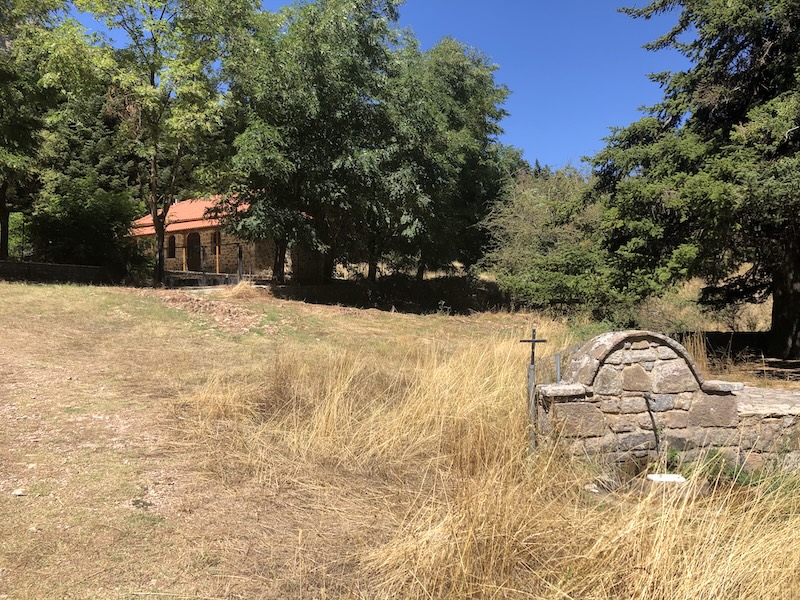
A little way further up you branch up steeply to the right, leaving the main path. Here the route-finding becomes a little more difficult, but there are faded paint splashes and plastic ribbons all the way up.

You come out above the treeline and enter an extraordinary sunken meadow area just below the summit ridge (pictured here from above, looking down from the summit ridge).
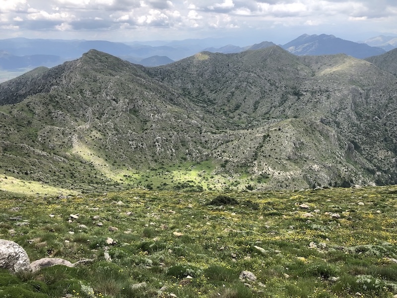
Then it’s another steep climb up, a left turn along the ridge, and up to the summit.

There are amazing views in all directions, and among other things it gives a wonderful overview of the plain stretching across to the eastern peaks of Mount Menalo.

You can either retrace your steps or follow the ridge a little further round beyond the summit before descending steeply back to the meadow area.

The round trip is about 12 km, with 1200 metres of ascent.
The start point for the route is here. The downloadable GPX file is below.